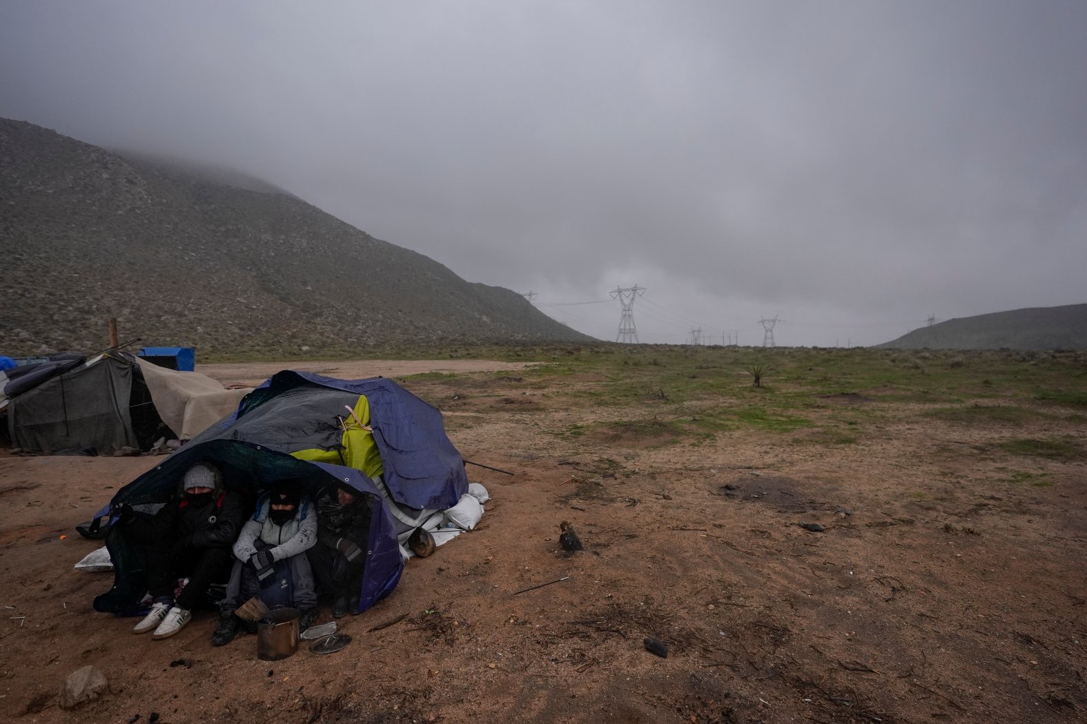
San Diego Area Faces Intense Late-Winter Storm

Table of Contents
San Diego, typically known for its sunny skies and mild weather, is bracing for an intense late-winter storm predicted to bring significant disruption. This powerful weather system is expected to deliver heavy rainfall, strong winds, and a potential for widespread flooding across the county. Residents are urged to prepare for the storm and take necessary safety precautions to protect themselves and their property. This San Diego storm is not to be taken lightly.
Heavy Rainfall and Flooding Concerns
The National Weather Service forecasts significant rainfall accumulation throughout San Diego County. Low-lying areas, areas near rivers and canyons, and recent burn areas are at especially high risk of flash flooding. This San Diego storm could lead to dangerous conditions.
- Rainfall Predictions: Predictions vary across the county, but some areas could see upwards of 3-5 inches of rain in a short period. Coastal areas may experience less, but inland regions are expected to bear the brunt of the rainfall.
- Mudslides: Recent wildfires have left the soil unstable in many areas. Heavy rainfall significantly increases the risk of devastating mudslides in these burn scar regions. Avoid these areas entirely.
- Avoid Flooded Roads and Waterways: Never attempt to drive or walk through flooded areas. The water may be deeper than it appears, and strong currents can quickly sweep you away.
- Sandbag Locations: Many cities are making sandbags available to residents. Check your local city's website for distribution points and availability.
- Flood Updates: Stay informed by monitoring the websites of the National Weather Service (NWS) and the San Diego County Office of Emergency Services for the latest flood warnings and updates.
High Winds and Potential Power Outages
Along with the heavy rain, the San Diego storm will bring strong winds. Gusts of up to 50 mph are possible, increasing the likelihood of power outages across the region.
- Wind Speed Predictions: Wind speeds will vary depending on location and elevation, but sustained winds of 25-35 mph are expected, with higher gusts possible in exposed areas.
- Securing Loose Objects: Secure any loose outdoor objects that could be blown around by the wind, such as patio furniture, trash cans, and debris.
- Downed Power Lines: Report downed power lines immediately to your local power company and avoid approaching them. Downed power lines are extremely dangerous.
- Preparing for Power Outages: Prepare an emergency kit including flashlights, extra batteries, a battery-powered radio, and a first-aid kit. Consider having a backup power source for essential appliances.
- Contact Information: Contact information for local power companies, such as SDG&E, should be readily available.
Safety Precautions and Storm Preparation
Taking proactive measures before, during, and after the storm is crucial for your safety and the safety of your family.
- Emergency Kit: Assemble an emergency kit containing bottled water, non-perishable food, a first-aid kit, medications, blankets, and other essential supplies.
- Charge Devices: Fully charge all electronic devices, including cell phones, laptops, and tablets.
- Weather Updates: Monitor weather reports closely through reliable sources like the National Weather Service and local news channels.
- Evacuation Routes: If you live in a flood-prone area or a wildfire burn scar, know your evacuation routes and have a plan in place.
- Protect Property: Secure windows and doors to prevent damage from high winds. Bring outdoor furniture inside.
Impact on Transportation and Schools
The severe weather is expected to significantly impact transportation and school schedules.
- Transportation Updates: Check websites of local transportation agencies for updates on potential road closures, flight delays, and public transit disruptions.
- School Closures: Monitor your school district's website and local news for announcements regarding school closures or delays.
- Alternative Transportation: Have alternative transportation plans in place in case of road closures or public transit delays.
Conclusion
The intense late-winter storm approaching San Diego poses a significant threat, requiring proactive preparation and adherence to safety guidelines. Heavy rainfall, strong winds, and potential flooding necessitate careful planning to minimize risks and ensure safety. This San Diego storm demands serious preparation.
Call to Action: Stay informed about the developing San Diego storm situation. Monitor weather reports closely, take necessary precautions, and prepare your home and family for the potential impacts of this severe late-winter storm. #SanDiegoWeather #StormSafety #WinterStormPreparation #SanDiegoStorm

Featured Posts
-
 Gorillaz House Of Kong Everything We Know About The New Concerts
May 30, 2025
 -
 Live Music Stock Slump Predicted To Continue Into Friday
May 30, 2025
 -
 Gaya Vs Performa Kawasaki W175 Dan Honda St 125 Dax Dibandingkan
May 30, 2025
 -
 Glastonbury 2025 Your Guide To Resale Ticket Sales
May 30, 2025
 -
 Susquehanna River Assault Case Moves Forward
May 30, 2025
